Development2 months ago
Enhancing Mapping Accuracy with LiDAR Ground Control Targets
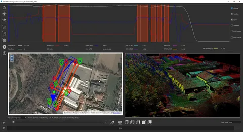
In geospatial data collection, surveyors use LiDAR ground control targets as vital tools that enhance the accuracy of aerial surveys and mapping projects. Whether they apply...